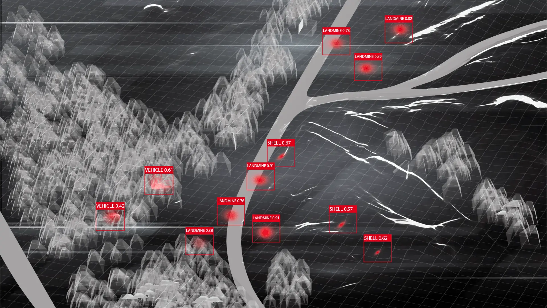
Landmine Detection using Deep Learning and Drones

Business Goals
- The primary objective was to develop a fast, safe, accurate, remote system for detecting landmines, reducing the risks associated with manual detection and increasing the efficiency and coverage of demining operations.
Challenge
- Landmines pose significant threats in post-conflict regions, resulting in numerous casualties and impeding socio-economic development. Traditional demining methods are labour-intensive, dangerous, and often imprecise, requiring an innovative and efficient solution to address this grave issue.
Results
- 22% Improvement in Detection Accuracy
The fine-tuned automated drone system demonstrated 92% average accuracy, reflecting a 22% improvement in correctly identifying landmines over the manual method with 70% accuracy. - 20-Fold Increase in Detection Speed
The automated system surveys up to 10,000 square meters per day, resulting in a 20-fold increase over the manual method with approximately 500 square meters per day. - 90% Decrease in Incidents
The AI drone system reduced the accident rate to 0.5 accidents per 1,000 operations, marking a 90% decrease in incidents compared to the manual landmine surveys with average of 5 accidents per 1,000 operations. - 80% Cost Reduction
Mine detection costs dropped to $1 per square meter, signifying an 80% cost reduction as opposed to the manual method costs of around $5 per square meter surveyed - 6-Day Reduction in Reporting Time
The automated system requires only 24 hours to analyze and report findings for a specific area, while the manual one takes about 7 days for the same process, showing a 6-day reduction in reporting time. - 83% Decrease in Environmental Disruption
The drone AI system reduced environmental disturbance to 5% comparing to the manual approach with approximately 30% of the surveyed area's vegetation disruption, marking an 83% decrease. - 80% Reduction in Training Effort
Manual Method: 200 hours of specialized training required for deminers
The automated system required on average 40 hours of training for drone operators and system maintenance, indicating an 80% reduction in training hours. - 2x Easier Scaling
Doubling AI drone detection operations require only a 50% increase in resources, while doubling manual operations require doubling personnel and resources.
Implementation Details
- Preliminary Research and Data Collection - 4 weeks
- Conducted a comprehensive review of existing landmine detection methods and their limitations.
- Gathered a preliminary dataset of aerial images highlighting anti-infantry and anti-vehicle landmines, locations, terrains, and false positives from various sources and contaminated areas.
- Identified specific limitations of using DJI drones and the most represented types of mines.
- Data Augmentation and Baseline Model - 4 weeks
- Expanded the dataset using augmentation techniques to ensure a robust training set, extending set of terrains and environmental conditions.
- Designed the baseline computer vision model architecture, focusing on convolutional neural networks (CNN) suitable for landmine detection tasks
- Performed hyperparameter tuning and trained the baseline CNN model.
- Drone Integration and Data Acquisition - 8 weeks
- Integrated the DJI drone with the mine detection software system.
- Established a data pipeline to process drone-captured images in real-time.
- Conducted field tests to collect real-time aerial data from multiple terrains.
- Mine Detection Model Optimization - 8 weeks
- Used the enhanced dataset to train the improved computer vision model.
- Iteratively optimized the model based on the cross-validation dataset performance, fine-tuning hyperparameters and revising the model architecture.
- Achieved significant improvements in real-world mine detection accuracy on multiple terrains and weather conditions.
- Final Deployment and Field Testing - 6 weeks
- Implemented the feedback loop to allow for real-time model adjustments based on field results.
- Integrated DJI drone and updated computer vision system.
- Conducted extensive field testing in real-world scenarios, assessing the model's performance in varied terrains and conditions.
Industry
Service
Type
- Template Solution
Keywords
- Data Annotation
- AI, ML, Data Science
- Mobile Development
Roadmap
Preliminary Research and Data Collection
Data Augmentation and Baseline Model
Drone Integration and Data Acquisition
Mine Detection Model Optimization
Final Deployment and Field Testing
Sign up to receive the project description
Want to talk?

Michael Gurbych
Director,
Operations and Finance
Operations and Finance
Roadmap
Preliminary Research and Data Collection
Data Augmentation and Baseline Model
Drone Integration and Data Acquisition
Mine Detection Model Optimization
Final Deployment and Field Testing